Survey and inspection services from Walsh Service Solutions
If you are in need of survey and/or inspection support, the team at Walsh Service Solutions can help.
Bathymetric Survey
Bathymetric, or hydrographic surveys, refer to submarine topography. Bathymetry is the foundation of the science of hydrography, which measures the physical features within a water body.
Bathymetric survey service can include:
- Harbor Surveys
- River Surveys
- Height Clearance (Transmission Lines, Bridges, Etc.)
- Beach Nourishment Surveys
- Shoreline Charting Surveys
- Aquaculture
- Dredging / Dredge Verification
- Rock Dumping
- 360 Mapping
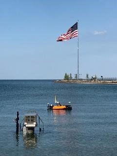
Unmanned Surface Vessel (USV)
USVs are a revolutionary platform that can carry all kinds of sensor arrays for hydrographic survey. Our USV has a footprint of only 78″ x 42″ x 32″, allowing it to fit in small vans. With a weight of 121 pounds assembled, and with the ability to be disassembled into parts weighing less than 44 pounds, a single operator can launch a USV.
Turnkey Integrated System
Our USV is the ultimate hydrographic survey tool with its robust catamaran design and tightly integrated bathymetric survey sensors. This system is a cost-effective turn-key solution for bathymetric surveys in sheltered waters such as small lakes, canals, rivers, ponds, and harbor areas. Its tight integration between the on-board control system, that enables autonomy, and the single or multi-beam echo sounder, a bathymetric survey can be executed with a simple, streamlined, safe, and effective workflow.
Drone Survey
Drones are continually proving to be powerful commercial tools, simultaneously providing leaps in efficiency and safety. The surveying and mapping industry is no exception. With the ability to capture data from above, drones have been successfully integrated into surveying workflows to perform land surveys, photogrammetry, 3D mapping, topographic surveying, and more. Drone surveys are also highly accurate – in an independent study by DroneDeploy, our drones achieved 2 cm relative vertical accuracy and 1.20 cm relative horizontal accuracy.
What kinds of deliverables can you achieve with drone surveying?
Depending on the choice of data sensors and surveying software, drone surveying can produce a variety of deliverables with use cases in many industries:
- 2D Orthomosaic Mapping – Surveying software can stitch together hundreds, or thousands of digital photos captured by our drones, and produce high quality 2D Orthomosaic maps
- 3D Orthomosaic Mapping – Large numbers of digital photos of your site survey can be compiled into a 3D orthomosaic map and can provide actionable topographic data
- 3D Modeling – We generate 3D models of targets in site survey for quick comparison with BIM
- Thermal Mapping – Surveys using a thermal camera can quickly identify targets with abnormal heat signatures
- LiDAR Point Cloud – Equipped with a LiDAR camera, our drones produce a high-density point cloud